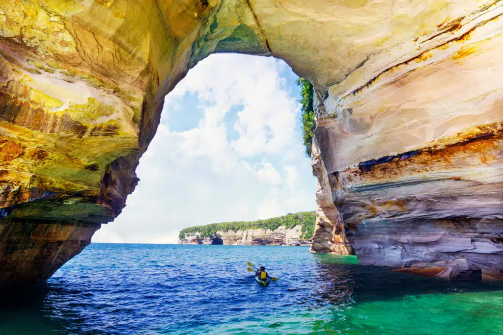

Most people meet Pictured Rocks from a boat deck or a scenic overlook. Both are worth doing. But if you want to understand this place, you have to get down to the waterline.
From a kayak, the scale of it lands differently. Cliffs go up two hundred feet directly out of the lake, close enough that you can see the wet mineral streaks running down the rock face, the reds and oranges that gave this shoreline its name. You can slide into openings at the base of the cliffs that are invisible from a hundred yards out. You can float under an arch and look up through it. You are also paddling water that Voyageurs, trappers, and Native people traveled long before any of this was a park, using the same rock formations as landmarks.
Paddling Michigan has been putting people on this water for more than twenty years, and this page is the honest version of what we tell guests before they paddle: what you will actually see, what the lake is actually like, when to come, and what a day out there really looks like.
What kayaking Pictured Rocks is actually like
Here is the shape of a day when you book a guided Pictured Rocks kayaking tour with us.
You check in at our offsite parking area on County Road H58, thirty minutes before your launch time. From there a short bus ride takes you out to Miners Beach, where we hand out gear and run the beach briefing: how to hold a paddle, how the boat behaves, and what the plan is given the conditions that day. You are not hunting for a parking spot at the beach and you are not burning daylight getting to the good part.
You launch off sand, straight into Lake Superior, in a two-seat tandem kayak. We use doubles on every tour, which is deliberate. They are more stable, easier for first-timers, and they let a stronger and a lighter paddler share a boat comfortably. The first few minutes are the adjustment. The water is clearer than you expect and the boat feels tippier than it is. Within twenty minutes most people have stopped thinking about the paddling at all.
"For the rest of the trip you are moving along a wall of sandstone with your guide naming formations, pulling the group into coves and caves, and watching the water."
Then the shoreline changes. Low banks give way to rock, the rock gets taller, and the color starts. Two things surprise most guests. The first is how manageable it is. These are stable sea kayaks and a steady, unhurried pace covers a lot of shoreline. The second is how quiet it is. Sound carries strangely along the cliff face. You hear water dripping off rock and not much else.
What you will see from the water
Everything starts at Miners Beach. From there you go one of two directions, and that choice decides your trip. Southwest takes you to Miners Castle and the best sea caves on the lakeshore. Northeast takes you along the long cliff line toward Shipwreck Point, Lovers Leap, and eventually Chapel Rock.
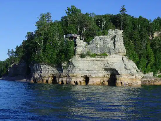
Miners Castle, the iconic sentinel of the lakeshore.
Miners Castle
A pale sandstone headland rising straight out of the lake, southwest of Miners Beach, and one of the most recognizable formations in the park. Worth knowing: this rock is actively changing. One of its turrets collapsed in 2006, a reminder that this is soft stone being worked on constantly by water and ice.
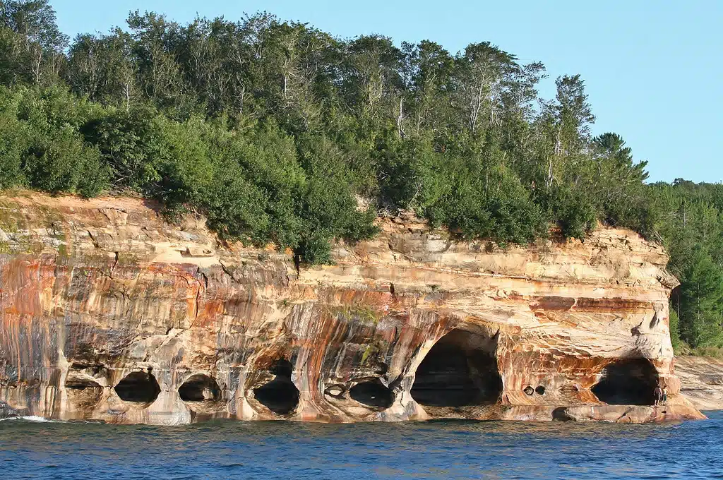
Peering out from the sandstone cathedrals at the waterline.
The sea caves
The base of the cliffs is undercut in dozens of places. Some are shallow alcoves, some are true caves you can put a bow into. The best concentration sits on the southwest stretch at the base of Miners Castle. Whether you can enter any given cave depends on the swell that day, which is a call your guide makes on the water.
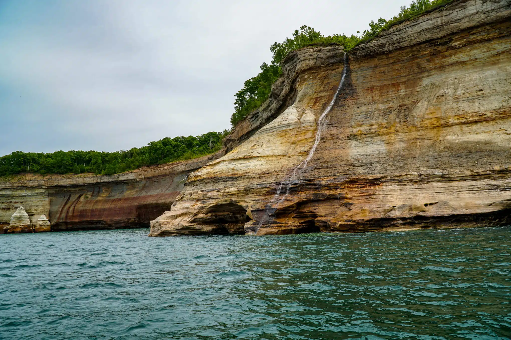
Bridal Veil Falls spilling into Lake Superior.
Bridal Veil Falls
The first major waterfall on the northeast route, coming off the escarpment along the cliff line. Sitting at water level while a falls comes down in front of you is the moment a lot of people say sold them on paddling over cruising.
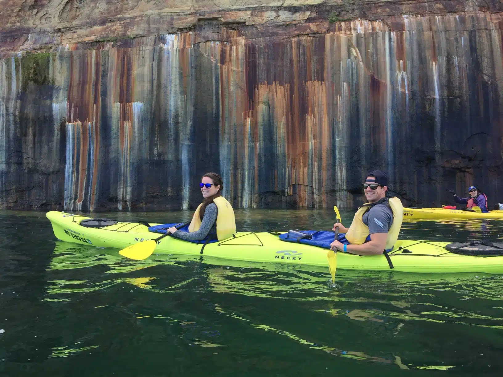
Natural mineral 'paintings' on the 200-foot sandstone walls.
The stained cliffs
The colors are not painted on. Groundwater seeps through two hundred feet of sandstone and carries dissolved minerals down the rock face. Iron leaves red and orange, copper leaves green and blue, manganese leaves brown and black. Eons of that seepage is what you are looking at. After a wet stretch the colors are noticeably stronger.
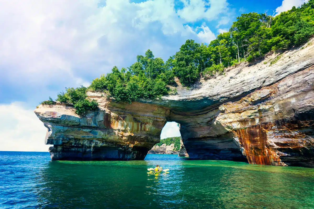
The dramatic archway of Lovers Leap.
Lovers Leap Arch
A natural sandstone arch and one of the most photographed formations on the lakeshore, reached on our longer trips. It stands as a testament to the power of wind and waves over millennia.
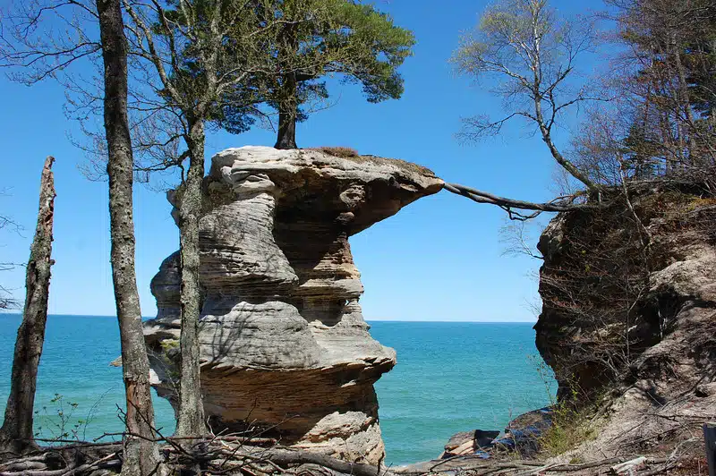
Chapel Rock and its resilient 300-year-old white pine.
Chapel Rock
The far end of the paddling stretch. Chapel Rock is a detached sandstone spire carrying a 300-year-old white pine, with a long exposed root stretching across an open gap to the mainland for nourishment. It is one of the most photographed features in the park and the finish line for our full day trip.
When to kayak Pictured Rocks
Season
Our tours run Memorial Day weekend and then daily through the end of September, with the full day Paddle and Hike running daily from mid June to mid September. Outside that window, Lake Superior conditions and water temperature make paddling here a serious undertaking rather than a recreational one.
Early season versus late season
Early summer tends to bring the strongest waterfalls, since the streams are still carrying spring runoff, and fewer people. Late summer usually brings the warmest air and the calmest average conditions.
Time of day
Mornings are typically calmest. Wind builds through the afternoon more often than not, so an early launch is the safer bet if you are weather-sensitive.
Evening is the other strong option. The cliffs face north and northwest, so the last light of the day hits them directly and the sandstone goes gold and orange. Two of our departures are built for it: the 3pm Paddler's Choice and the 6pm Taste of the Rocks.
What the lake is actually like
This is the part first-timers underestimate, and it is worth being straight about. Lake Superior is cold. It stays cold through the summer, cold enough that an unplanned swim is a real problem rather than a refreshing dip.
It also changes quickly. A flat morning can build into a chop by early afternoon with no warning a visitor would recognize. And along much of this shoreline there is nowhere easy to land, because the shoreline is a wall.
Respect the lake, go with people who know it, and you will have a spectacular day.
Do you need experience?
No. Most of the people we take out have never been in a sea kayak. All skill levels are welcome on our tours.
We use two-seat tandem kayaks, which are considerably harder to tip than solo recreational boats. You get a full briefing on the beach before you launch, your guide sets a pace the whole group can hold, and there is no expectation that you arrive knowing anything.
What to bring and what is provided
Provided on every tour
- Two-seat tandem sea kayak
- Paddle, spray skirt, and PFD
- Trained, US Forest Service guide
- Bus shuttles to Miners Beach
- Full safety briefing
Bring yourself
- Water (at least 2 liters)
- Water shoes or sandals
- Sun protection (hat, sunblock)
- Quick-dry layers (no cotton)
- Snacks and camera
- A warm extra layer
Which tour should you book?
The honest answer depends on your time and energy more than your ability. All four leave from the same place in Munising.
Morning Delight
Our shortest and most affordable trip, built for people who are short on time or who cannot manage a longer day. You paddle southwest from Miners Beach to Miners Castle and the best sea caves in the park.
- Miners Castle
- Sea Caves
- Tall Cliff Lines
Taste of the Rocks
Our half day trip and the easiest one to fit into a travel day. About five miles of paddling, seven named formations, and two waterfalls. We paddle this at a deliberately slower pace.
- Shipwreck Point
- Stained Cliffs
- Bridal Veil Falls
Paddler's Choice
Our most popular trip. Eleven formations and three waterfalls, with a full hour stopped for lunch on a remote beach with no road access. Bring your own lunch.
- Mosquito Beach Lunch
- Lovers Leap Arch
- Caves of the Bloody Chiefs
Paddle and Hike
Our most exclusive trip. Fourteen miles of paddling, twenty-seven cliff formations, and four waterfalls. One-way paddle followed by a 3.1 mile hike through the Chapel Basin Loop.
- Grand Portal Point
- Battleship Row
- Chapel Rock
- 3.1 Mile Guided Hike
Can you kayak Pictured Rocks on your own?
Legally, yes. Practically, this is not a place for casual self-guided paddling.
The combination that makes this coastline hazardous is specific: cold water year round, conditions that shift faster than a visitor can read them, limited landing options, and no cell coverage. For the large majority of visitors, go with a guide.
Making a trip out of it
Munising is small, and most people come for more than a day. Beyond the paddle, Paddling Michigan can put together the rest of it: lodging including yurts, meals, and a Grand Island boat cruise.
Come paddle it
Twenty years on this coastline, four trip lengths, departures every day of the season including sunset. We will handle the boats, the gear, and getting you to the water.
Or call (906) 387-1695